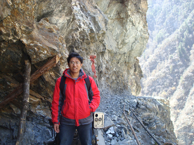
钟成
1981-,男,博士,副研究员,中国地质大学(武汉)湖北巴东地质灾害国家野外科学观测研究站。
Tel: 15827301696
Email: zhonglxm@cug.edu.cn
教育背景
2004.9 – 2009.6 硕博连读 武汉大学 摄影测量与遥感 导师:李德仁院士、邵振峰教授、黄先锋教授
2000.9 – 2004.7 学士 武汉大学 地图学与地理信息系统
教学和研究生培养
主讲课程:工程地质遥感
研究生刘月获2021年中国地质大学优秀毕业生,发表SCI论文4篇。
研究生李畅获得2021年度国家奖学金,发表SCI论文2篇。
研究工作
负责国家野外科学观测研究站遥感监测工作。利用三维激光扫描仪、测量机器人、无人机、InSAR和光学影像构建地质灾害立体监测网络,开展相关运维、分析和研发工作。面向全球气候变化,开展环境遥感研究,
科研项目
2021.6-2022.06 云南省地质科学研究所“InSAR技术应用和典型地质灾害综合遥感专题研究”
2021.01-2022.07 深圳市国土资源和规划局“基于深度学习的粤港澳大湾区城市局部气候区遥感识别研究”
2018.12-2020.6 深圳市国土资源和规划局“1978-2018深圳市绿色空间空间格局演变与生态环境效应研究”
2018.01-2021.12 国家自然科学基金面上项目(41772352)“大数据支持下利用局部条件约束的滑坡自动识别问题可靠求解方法研究”
2018.07-2019.06 湖北省水利厅项目“巴东、兴山、夷陵高切坡地面三维激光扫描”
2012.01-2014.12 国家自然科学青年基金(NSFC)“面向滑坡表面变形监测的地面激光扫描数据曲面元分析方法”
2012.01-2013.12 武汉市科技攻关计划(Wuhan R&D)“基于遥感影像的武汉市城市景观格局演变及生态安全”
学术服务
湖北省地震学会理事,中国地质学会终身会员,美国地理学者协会(AAG)会员
Sensor客座编辑, ISPRS Journal of Photogrammetry and Remote Sensing, Environmental Modelling and Software, Photogrammetric Engineering and Remote Sensing,International Journal of Remote Sensing, IEEE Geosciences and Remote Sensing Letter,Remote Sensing,Sensor Review,The International Journal of Systems & Cybernetics,Environmental Earth Sciences, Environmental Engineering Research, Urban climate等杂志审稿人。
主要论文 (*代表通讯作者)
Zhong, C.; Li, C.; Gao, P.; Li, H.* Discovering Vegetation Recovery and Landslide Activities in the Wenchuan Earthquake Area with Landsat Imagery. Sensors 2021, 21,5243.
Li, C.; Yi, B.; Gao, P.; Li, H.; Sun, J.; Chen, X.; Zhong, C.* Valuable Clues for DCNN-Based Landslide Detection from a Comparative Assessment in the Wenchuan Earthquake Area. Sensors 2021, 21, 5191.
Liu, Y.; Li, H.; Gao, P.; Zhong, C.* The Spatial-temporal Dynamics of Urban Green Space and Its Impacts on Thermal Environment in Shenzhen City from 1978 to 2018. Photogrammetric Engineering and Remote Sensing, 2021, 87(2), 81-89.
Liu, Y.; Li, H.; Li, C.; Zhong, C.; Chen, X.* An Investigation on Shenzhen Urban Green Space Changes and Their Effect on Local Eco-Environment in Recent Decades. Sustainability 2021, 13, 12549.
Liu, Y.; Li, H.; Gao, P.; Zhong, C*. Monitoring the Detailed Dynamics of Regional Thermal Environment in a Developing Urban Agglomeration. Sensors, 2020, 20(4), 1197.
Zhong, C., Liu, Y., Gao, P., Chen, W., Li, H.*, Yong Hou, Tuohuti Nuremanguli & Haijian Ma. Landslide Mapping with Remote Sensing: Challenges and Opportunities. International journal of remote sensing, 2020,41 (4): 1555-1581.
Zhong, C. , Chen Chen, Liu, Y. , Gao, P. , Li, H.*. A Specific Study on the Impacts of PM2.5 on Urban Heat Islands with Detailed in situ Data and Satellite Images. Sustainability, 2019, 11, 7075.
Li, H., Chen, W., Yong Hou, Zhong, C.*, Comparative Tests on Methods for Automatic Mapping of Land Cover Dynamics from Multi-year Images. Remote sensing letter. 2019, 10(8): 746-755.
Zhong, C. , Wang, C. , Li, H. *, Chen, W. and Yong Hou *. Mapping Inter- Annual Land Cover Variations Automatically Based on a Novel Sample Transfer Method. Remote sensing, 2018, 10(9), 1457.
Jinge Wang, Aijun Su, Qingbing Liu, Wei Xiang, Hsin-Fu Yeh, Chengren Xiong, Zongxing Zou, Zhong, C., Junqi Liu, Shen Cao. Three-dimensional analyses of the sliding surface distribution in the Huangtupo No. 1 riverside sliding mass in the Three Gorges Reservoir area of China. Landslides, 2018, 15(7), 1425–1435.
J Liu, H Tang, Q Li, A Su, Q Liu, C Zhong. Multi-sensor fusion of data for monitoring of Huangtupo landslide in the three Gorges Reservoir (China), Geomatics, Natural Hazards and Risk, 2018, 9 (1), 881-891
Li, H., Wang, C., Zhong, C. *, Zhi Zhang *, Qingbing Liu. Mapping Typical Urban LULC from Landsat Imagery without Training Samples or Self-Defined Parameters. Remote sensing, 2017, 9(7), 700.
Li, H., Wang, C., Zhong, C. *, Aijun Su,Chengren Xiong; Wang, Junqi Liu, Mapping Urban Bare Land Automatically from Landsat Imagery with a Simple Index. Remote sensing. 2017, 9(3), 249.
Li, H., Zhong, C.*, A machine vision based autonomous navigation system for lunar rover: the model and key technique, Sensor Review, 2016, 36(4): 377-385. (If=1.070)
Jinge Wang, Aijun Su*, Wei Xiang, Hsin-Fu Yeh, Chengren Xiong, Zongxing Zou, Zhong, C., Qingbing Liu. New data and interpretations of the shallow and deep deformation of Huangtupo No. 1 riverside sliding mass during seasonal rainfall and water level fluctuation. Landslides, 2016, 13(4): 795–804.
Zhong, C., Wang, C.*, Changshan Wu. MODIS-based Crop Mapping in the U.S. Midwest with Spatially Constrained Phenology Mixture Analysis. Remote Sensing. 2015, 7(1), 512-529.
Li, H., Zhong, C.*, Huang, X. New Methodologies for Precise Building Boundary Extraction from LiDAR Data and High Resolution Image. Sensor Review. 2013, 33(2): 157-165.
Li, H., Zhong, C.*, Huang, X., (2012) Reliable registration of LiDAR data and aerial images without orientation parameters, Sensor Review, 32(4), pp.280–287.
Zhong, C., Li, H.*, Wei Xiang, et al. Comprehensive Study of Landslides through the Integration of Multi Remote Sensing Techniques: Framework and Latest Advances. Journal of Earth Science. 2012, 23 (2), pp. 243–252.
Zhong, C.*, Li, H. , Huang, X., Deren Li, A Fast and Effective Method for Generating True Ortho Photos in Built-up Area. Sensor Review, 2011, 31(4): 341-348. (If=1.070)
Zhong, C.*, Li, H. , Zonghua Li, Deren Li, A Vector-Based Backward Projection Method for Robust Detection of Occlusions When Generating True Ortho Photos. GIScience & Remote Sensing, 2010, 47(3): 412-424.

